
Breaking News
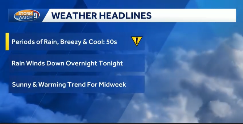
Periods of Rain Today
Rain Slowly Ends Tonight

Last Complete Site Update: 9/28 - 7:36 AM
Weather for New England and the Northeast
Updated Twice per day
Delivering Weather Forecasts for New England for 27+ years.
"More than a forecast. RichLefko.com provides in-depth New England weather analysis, climate statistics, rainfall and snowfall tracking, drought monitoring, and enhanced National Weather Service discussions for weather enthusiasts and informed decision-makers."
Just need the daily forecast?
We have that as well.
Active Hazards, Advisories, and/or warnings
None
None
None
If the alert below is flashing, then the warnings/advisories above are active. Use those links to go to that hazard page.

"Fall has always been my favorite season. The time when everything bursts with its last beauty, as if nature had been saving up all year for the grand finale."
- Lauren DeStefano
Today’s Weather at a Glance
Updated Every Morning and as Needed Through the Day
(Averages Across Southern NH)
57Degrees
High Temperature
90%
Probability of Precipitation - Daytime
47Degrees
Low Temperature
40%
Probability of Precipitation - Nighttime
Personalize your settings on the panel.
Today in Peterborough, NH at a Glance
Current Conditions, Nashua NH
Today in Nashua, NH at a Glance
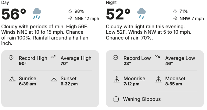
Your Daily Forecast - Three Days at a Time

Multiple Advisories are active.
Wind and Flood
Monday/Monday Night - September 28
Nashua - East

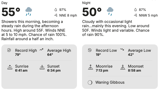
Rain. Patchy fog after 8am. High near 59. Northeast wind 10 to 15 mph, with gusts as high as 25 mph. Chance of precipitation is 90%. New precipitation amounts between a quarter and half of an inch possible.

Rain, mainly before 11pm. Patchy fog. Low around 48. North wind around 5 mph. Chance of precipitation is 80%. New precipitation amounts between a tenth and quarter of an inch possible.
Peterborough - Central/West
Rain. Patchy fog. High near 56. Northeast wind 5 to 10 mph. Chance of precipitation is 90%. New precipitation amounts between a quarter and half of an inch possible.

Rain likely, mainly before 10pm. Patchy fog. Otherwise, cloudy, with a low around 46. North wind around 5 mph becoming calm in the evening. Chance of precipitation is 70%. New precipitation amounts between a tenth and quarter of an inch possible.
Tuesday/Tuesday Night - September 29
Nashua - East

Patchy fog before noon. Otherwise, partly sunny, with a high near 68. North wind around 5 mph.

Mostly cloudy, with a low around 50. Calm wind.
Peterborough - Central/West
Patchy fog before noon. Otherwise, partly sunny, with a high near 64. Calm wind becoming northwest around 5 mph in the afternoon.

Partly cloudy, with a low around 47. Calm wind.
Wednesday/Wednesday Night - September 30
Nashua - East

Mostly sunny, with a high near 73. Calm wind.
Partly cloudy, with a low around 52.
Peterborough - Central/West
Mostly sunny, with a high near 70. Calm wind.
Partly cloudy, with a low around 51.
Thursday/Thursday Night - October 1
Nashua - East


Peterborough - Central/West
Friday/Friday Night - October 2
Nashua - East
Peterborough - Central/West
Saturday/Saturday Night - October 3
Nashua - East
Peterborough - Central/West
Sunday/Sunday Night - October 4
Nashua - East
Peterborough - Central/West
Current Weather Readings in Peterborough, NH
Time of the readings below: D$
(FYI: The number in parentheses is the change in the last hour)
(Note: My weather Instruments are Offline from Midnight Wednesday to 7AM Thursday for system Back ups.)
Current Temperature:
CT$
High Temperature:
STAT$TEMPERATURE:MAX:TODAY$ at STAT$TEMPERATURE:MAX:TODAY:TIME$
Low Temperature:
STAT$TEMPERATURE:MIN:TODAY$ at STAT$TEMPERATURE:MIN:TODAY:TIME$
Precipitation Today:
STAT$RAIN:TOTAL:TODAY$ inches
Current Dewpoint:
CD$
Highest Heat Index Reading:
STAT$HEATINDEX:MAX:TODAY$ at STAT$HEATINDEX:MAX:TODAY:TIME$
Current Windspeed:
CW$
Barometric Trend:
BTTEXT$
Hours of Daylight Today:
DAYLIGHTTIME1$
Link to my Active Weather Instruments

Current Conditions - Nashua NH
Information for New England
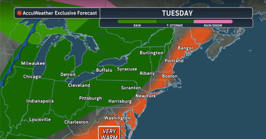
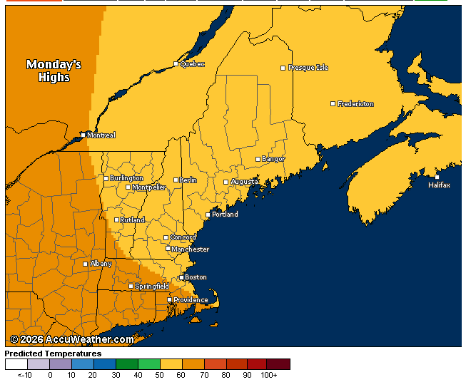
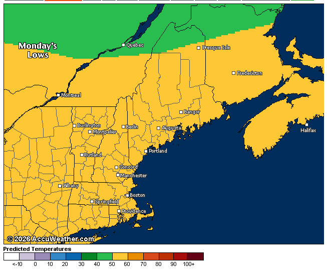
Seven Day Temperature Outlook - Manchester NH & Southern New England
Current Northeast Radar

Expected Temperature Range
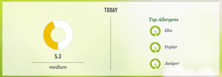
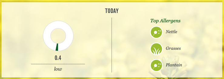
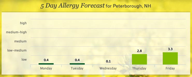
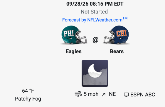
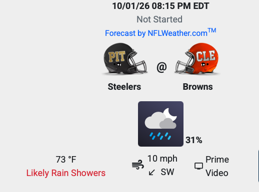
Health/Sports - The Five Day Allergy & NFL Football Weather by Game
Rich's Weather Discussion
New Hampshire/North Briefing
Massachusetts/South Briefing
At this moment: 9/28 - 7:36 AM
Notes from Rich:
What is the 'Regular’ Schedule.
Weekdays: Morning updates each day before 8AM, Evening Updates before 7PM.
On Weekends: Perhaps a bit later. I like to sleep in.
Every Thursday morning I post the daily forecast through the weekend.
Upcoming Site Update Schedule Changes:
Back on the regular schedule
Periods of rain today into tonight. The rain finally ends later tonight, though I can’t rule out a stray shower Tuesday morning.
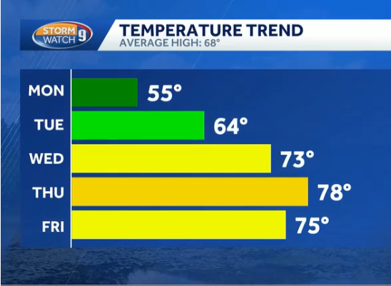
Skies begin to show us more sunshine, with warmer temps into the late week period.
A weakening nor'easter will continue to bring periods of rain, gusty northeast winds, rough surf, and an elevated risk of rip currents across coastal areas today. The storm will gradually pull away tonight, with improving conditions Tuesday. The second half of the week looks warmer and generally drier, although a stray shower is possible Wednesday or Thursday, with slightly better rain chances Friday.
Tropical Depression Fay remains in the Atlantic.
I have added NFL Football Weather for each game- Updated weekly/daily as needed - Find the list here
========================================
Join us, it costs nothing:
Join over 250 of your fellow weather watchers who get my every Thursday evening 'Weekend Outlook' e-mail blast. This is a free service, with no spam ever (because I manage the list) that arrives in your E mail box every Thursday evening. I also use this list for special warnings, blizzards, hurricanes, severe weather alerts.
You sign up, you control it, quit at any time. In 27+ years I have never given away an email address, and you will never receive any spam because you signed up.
The sign up form is at the bottom of this page.
====================
What information can you find on my site, and where is it?
The History Section has a lot of history to share, and I will be sharing video on this page from time to time. Updated every day with new weather history.
Find beach and hiking, and Ski information as well as travel info for the USA in the Travel and Leisure Section.
Find all Tropical Tracking/Hurricane information on the Tropics Page.
Find the current Drought Maps here. Now showing a map for each New England State.
Looking for Radar? Try the Radar Page.
Looking for Weather News from Across the globe, plus more local weather info? Look here.
Note: When you move your cursor over an image, the image fades. Click on the image and that opens a lightbox view that expands the image and allows you to click through all of the images in a section.
=============
On this day in history:
On this day in 1960, Ted Williams stepped to the plate at Fenway Park for the last time and hit a home run, the 521st of his career, then refused to tip his cap to the crowd.
Weather Summaries and Full Area Forecast Discussions - North (Edited)
Summary - Northern New England - New Hampshire and Maine
Summary:
A weakening nor'easter will continue to bring periods of rain, gusty northeast winds, rough surf, and an elevated risk of rip currents across coastal areas today. The storm will gradually pull away tonight, with improving conditions Tuesday. The second half of the week looks warmer and generally drier, although a stray shower is possible Wednesday or Thursday, with slightly better rain chances Friday.
Key Messages:
- Periods of rain will continue through today, while winds and offshore seas gradually decrease as the nor’easter weakens. Rough surf and a high risk for rip currents will continue at the beaches today.
- After the nor’easter moves away Tuesday, warmer and drier conditions are expected during the second half of the week.
What has changed since the last Forecast Update?
A Coastal Flood Statement has been issued for coastal York and Rockingham counties for this afternoon’s high tide. Lingering wave action combined with elevated water levels could produce some spotty minor flooding in the most vulnerable locations. The Small Craft Advisory has also been extended for western Penobscot Bay through this morning.
Otherwise, only minor near-term forecast updates were made.
What this means for you:
Expect a damp, raw, and breezy Monday, with periods of rain and locally heavy downpours, especially near the coast. Beach conditions remain hazardous, with rough surf, dangerous rip currents, and some additional beach erosion possible around today’s high tide. Conditions improve Tuesday as the nor’easter moves away, followed by warmer and mostly dry weather later in the week.
Click the Open/Close Button to Display the Full Edited Area Forecast Discussion
**Area Forecast Discussion, National Weather Service Gray ME, 629 AM EDT Monday, September 28, 2026**
**What Has Changed**
A Coastal Flood Statement has been issued for coastal York and Rockingham counties for this afternoon’s high tide. Lingering wave action combined with elevated water levels could produce some spotty minor flooding in the most vulnerable locations. The Small Craft Advisory has also been extended for western Penobscot Bay through this morning.
Otherwise, only minor near-term forecast updates were made. The aviation section was also updated for the 12Z Terminal Aerodrome Forecasts, or TAFs, which are airport weather forecasts. The 12Z issuance corresponds to 8 AM EDT.
**Key Messages**
1. Periods of rain will continue through today, while winds and offshore seas gradually decrease as the nor’easter weakens. Rough surf and a high risk for rip currents will continue at the beaches today.
2. After the nor’easter moves away Tuesday, warmer and drier conditions are expected during the second half of the week.
**Discussion**
**Key Message 1**
Early Monday morning, the weakening nor’easter is located just south of Long Island, New York. The center of the storm will continue to weaken as it moves northeast through the Gulf of Maine tonight.
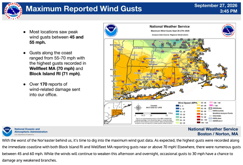
The main effects from the storm today will be bands of locally heavy rain rotating in from the ocean through this evening. These rain bands are fairly narrow, so not everyone will experience the heavier rainfall. Otherwise, cloudy skies, drizzle, and a raw northeast breeze will continue, with wind gusts gradually decreasing.
The High Surf Advisory has been extended through this afternoon. A naturally high astronomical tide around midday will combine with large ocean swells, increasing the risk for dangerous rip currents and additional beach erosion. Some minor splashover is also possible around the time of high tide today.
**Key Message 2**
After the nor’easter moves offshore, the 500 mb atmospheric pattern, which describes weather conditions roughly 18,000 feet above the surface, favors the development of a ridge over the eastern United States. A ridge is an area of higher pressure aloft that generally supports more stable weather.
With high pressure developing south of New England, temperatures should moderate during the middle and latter part of the week, with mainly dry conditions. Some weak instability, meaning a limited amount of rising air that can support showers, could allow an isolated shower to develop Wednesday or Thursday, but most locations should remain dry.
Rain chances become somewhat higher Friday as a cold front moves southward across New England. However, rain chances are expected to remain in the slight-chance category because the front is weak and any available instability will have to overcome a modest subsidence layer. Subsidence means sinking air, which tends to suppress cloud and shower development.
High pressure is then expected to dominate the weather over the weekend.
Weather Summaries and Full Area Forecast Discussions - South (Edited)
Summary - Southern New England - Massachusetts/Northern CT/Rhode Island
Summary:
Windswept rain, gusty winds, and minor coastal flooding continue across southern New England Monday as the weakening nor easter gradually moves north and east. Additional rainfall could produce localized urban and poor drainage flooding, with some rivers and streams remaining elevated. Conditions improve Tuesday, followed by mainly dry and warmer weather through Friday. Forecast confidence decreases for next weekend because weather models are showing several different possible scenarios.
Key Messages:
- Windswept rain with minor coastal flooding and beach erosion continues Monday. Localized urban and street flooding is possible.
- Minor coastal flooding continues through Monday evening.
- Conditions improve Tuesday, followed by mainly dry and warmer weather through Friday. Forecast confidence decreases next weekend.
What has changed since the last Forecast Update?
Some Small Craft Advisories have been dropped, along with the High Surf Advisory. Another period of unsettled weather is possible toward next weekend, but confidence in this outcome remains low.
What this means for you
Expect a damp, breezy Monday with occasional showers and periods of heavier rain. The main concerns are additional rainfall flooding, especially in poor drainage areas, along with minor coastal flooding around high tide. Tuesday brings a noticeable improvement, although clouds and a few lingering showers are possible early. The rest of the week should be quieter and warmer, with temperatures generally in the 70s. Next weekends forecast remains uncertain.
Click the Open/Close Button to Display the Full Edited Area Forecast Discussion
**Area Forecast Discussion, National Weather Service Boston/Norton MA, 233 AM EDT Monday, September 28, 2026**
**What has Changed**
Some Small Craft Advisories have been dropped, along with the High Surf Advisory. Another period of unsettled weather is possible toward next weekend, but confidence in this outcome remains low.
**Key Messages**
Windswept rain with minor coastal flooding and beach erosion continues Monday. Localized urban and street flooding is possible.
Minor coastal flooding continues through Monday evening.
Conditions improve Tuesday, followed by mainly dry and warmer weather through Friday. Forecast confidence decreases next weekend.
**Discussion**
**Key Message 1, Windswept rain and flooding concerns**
The center of the storm circulation, based on nighttime satellite imagery and surface observations early this morning, is along the New Jersey coast. Regional radar shows bands of precipitation continuing to move north and west into southern New England.
Over the next 12 to 18 hours, the low pressure system will weaken and move north, passing over southern New England this evening before reaching the Gulf of Maine on Tuesday. As a result, a major change in conditions is not expected today.
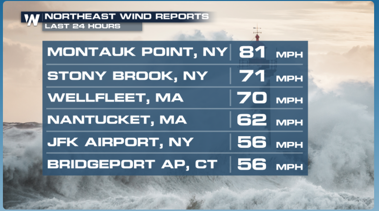
Low clouds, occasional showers, and breezy winds will continue through much of Monday. With the threat of damaging winds now diminished, the primary concern is flooding from additional rainfall.
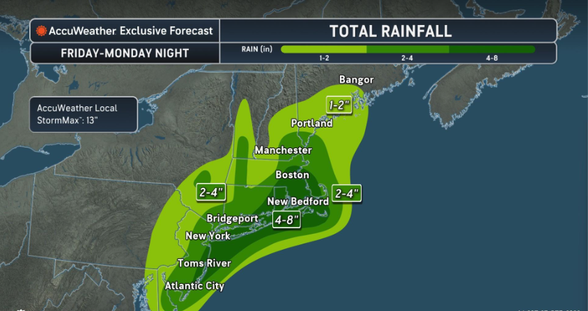
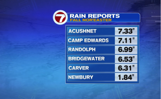
Southern New England has received anywhere from 1 inch in western Massachusetts to 5 to 7 inches across Rhode Island and southeastern Massachusetts during the past 2 to 3 days. The atmosphere remains very moist, even though the storm is no longer as strong as it was earlier. Precipitable water, or PWAT, values are approaching 1.5 inches. PWAT measures the total amount of moisture contained in a column of the atmosphere, and higher values indicate a greater potential for heavy rainfall.
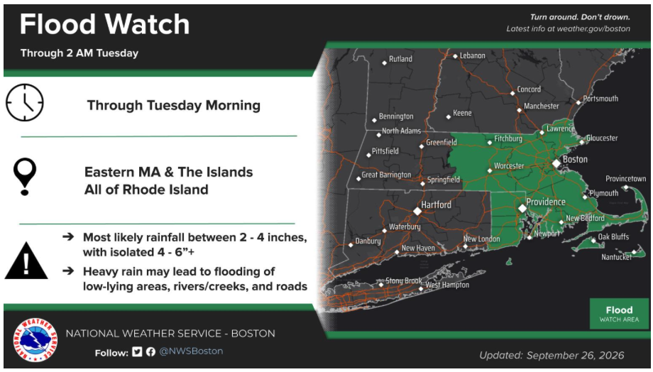
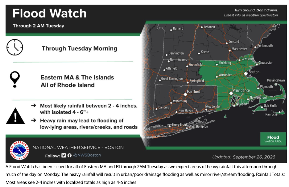
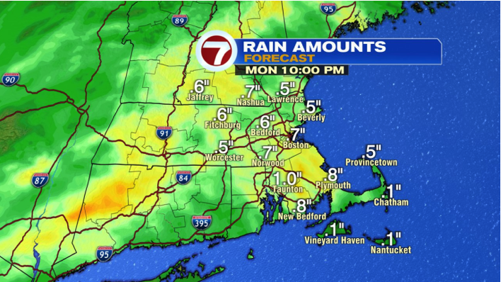
Another 1 to 1.5 inches of rain could fall in some locations before the rain tapers off Monday night. The Flood Watch remains in effect.
Urban areas and locations with poor drainage could experience flooding during the heaviest downpours. A few small rivers and streams will also continue rising into minor flood stage, including the Taunton River at Bridgewater.
**Key Message 2, Minor coastal flooding**
The secondary concern is minor coastal flooding caused by continued northeast winds and high astronomical tides.
Several tide gauges, including Boston Harbor and Nantucket, remained just below flood stage overnight. However, Monday afternoons astronomical high tide will be higher than Sundays high tide. With roughly 1.5 feet of storm surge still expected, minor coastal flooding will continue to be monitored.
The highest coastal water levels are expected around high tide, during the morning along the south coast and during the early afternoon along the east coast.
**Key Message 3, Improving conditions and warmer weather**
The weekends long-duration nor easter will move away to the east-northeast as the upper-level weather pattern becomes less amplified and blocking decreases.
For the remainder of the week, the upper-level flow becomes fairly zonal, meaning the overall flow will be more west to east, with a few weaker weather disturbances moving through during the middle and latter part of the week. These disturbances could produce a light shower or two, but mainly dry weather is expected.
A marked improvement arrives Tuesday as the weakening nor easter moves away and winds shift to the northwest. This northwest flow will bring drier air into southern New England and help end any lingering early morning showers.
Although moisture levels will remain somewhat elevated Tuesday afternoon, there will be little atmospheric support for additional precipitation. Clouds may therefore remain stubborn through much of the afternoon before some breaks develop later in the day.
Northwest winds will keep temperatures a few degrees below normal, although Tuesday will be noticeably warmer than this past weekend. High temperatures should reach the upper 60s to around 70 degrees.
**Wednesday through Friday**
A ridge of higher pressure builds across the southeastern United States this week, while surface high pressure settles south of the region from Wednesday through Friday. This will lead to a stretch of quieter and warmer weather.
Forecast guidance shows a weak disturbance moving through Wednesday night into early Thursday, followed by another weak disturbance Thursday night into Friday. Precipitable water values Wednesday night into Thursday should remain below 1.2 inches and will not line up particularly well with the strongest atmospheric forcing.
Outside of a brief light shower, more clouds than precipitation are expected. Moisture levels increase to around 1.5 inches Thursday night as the second weak disturbance moves through, and a few light showers could brush the region.
No significant impacts are expected from either disturbance.
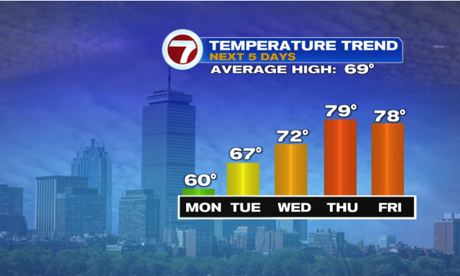
Temperatures will trend warmer through the middle and latter part of the week, although the latest forecast guidance has become somewhat cooler compared with previous forecasts. Highs should generally return to the lower and middle 70s, with Thursday potentially being the warmest day as temperatures reach the middle to upper 70s.
No notable overnight cold is expected, with lows generally in the 50s.
**Next Weekend**
Forecast confidence decreases next weekend because the weather models are showing considerable disagreement.
Some forecast solutions show a pattern somewhat similar to earlier this week, with another strong area of high pressure over eastern Canada and low pressure developing off the Carolina coast.
Other forecast guidance instead places high pressure over New England while low pressure develops across the Ohio River Valley and approaches the region late in the weekend or early the following week.
Because the possible weather patterns are significantly different at this time range, the forecast is likely to change as the weather models come into better agreement.
Countdown to Winter
Winter Begins on: December 21, 2026 at 4:50 PM EST
90Days14Hours6Mins14Secs
Five Day Daily Temperature Run - Peterborough, NH
Updated Every Morning
Normal Daily Averages
High Temperature: 64 Degrees - Low Temperature: 42 Degrees
(Tip: Place your cursor over the bar below to see the number)
Weather News/Headlines of Interest -
Updated Daily

Nor'easter to bring final day of rain to millions as communities assess flood and beach damage
Powerful nor'easter slowly pulls away after flooding, strong winds batter Northeast
See it: Powerful nor'easter unearths 19th-century shipwreck on New England shore
Atlantic goes more than 300 days without a hurricane as historic drought nears milestone
Hurricane Nolo brings dangerous flooding to Hawaii after being downgraded to Category 1 storm
RichLefko.Com Sponsors
Please patronize those running ads below - They are the lifeblood of RichLefko.com
Click on the company logo to go directly to their site.
Anrik Irrigation
My Longest Sponsor, I am pleased to present Anrik Irrigation. Anrik Irrigation is a full service lawn sprinkler company. They perform a variety of services, installation, maintenance, fall blow-out, spring start-ups, and offer a great brand of deicer for winter. Ask me!!

Freedom Cad
Freedom Cad offers PCB Design Services, Enginerring Services, and other value added services. They are headquartered in Nashua NH.
Freedom Cad Offers: PCB Design Services, Engineering Services, and Value Added Services.
Download their free eBook, The Printed Designer`s Guide to Executing Complex PCBs.
Download Now

Patton Energy - Keene NH
Discover the Patten Energy Difference
At Patten Energy, our philosophy is simple. We believe that bigger is not always better! We are neighbors serving neighbors - where you will always be referred to by name, never as just another account number. We are dedicated to maintaining the personal touch and quality care only a family run business can provide.
I use Patten Energy, and I heartily endorse them.

Dan's Tutorials
If you own ANY Apple products, I can highly recommend Dan's Tutorials. I am a visual learner and Dan's vidoes walk you through each and every option whether you are using an iPad/iOS, or a Mac/Mac OS, or an Apple Watch. Dan has you covered on ALL Apple devices.

All Tree
Need tree removal service? Snow Plowing?
I use ALL TREE, based in Jaffrey NH.
Fully Insured - Free Estimates
Quality Professional Tree Care with over 20 years of Experience
Fair pricing, and these guys do a great job.
Click the logo to go to the website.
Please contact Roy Watson at: 603-782-6659

Flood Watches are active!
There are active Flood Watches for Southern NH, especially here in SW NH.
Click the button below to see the Flood Watches.
This box will close in 15 seconds.
Click the X above to dismiss this box if you do not want to wait.
Subscribe to my Alerts
Subscribe to my Weather Alerts and get the Every Thursday Evening 'Weeked Outlook'
E-mail.
You manage your subscription.
Cancel whenever you want.
BTW, we do not sell, trade, give away, post, whisper, dream about, tattoo, print or share your e-mail addresses with anyone...EVER!
When you subscribe, your address goes directly to me, not some online service.
Subscribe once and get all e-mails and warnings!
Yes, you can subscribe to multiple addresses, home, office etc.
Zero cost - No ads-No tracking
Just the Weather - No Hype
Add a Richlefko.com app icon to iphone/ipad
Add a RichLefko.com icon to your iPhone or iPad. It is easy. If you find yourself frequently visiting a website or using a web app on your iPhone or iPad, it is very easy to add a shortcut icon directly on your Home screen using Safari that you can quickly tap to launch the site. This is how: How to add a website tile to your iphone or iPad home screen
Proud member of the National Weather Service Skywarn Program